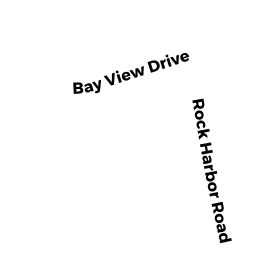
113 ROCK HARBOR RD
Owner Information
TOWN OF ORLEANS
19 SCHOOL RD
ORLEANS, MA 02653


Property Details
113 ROCK HARBOR RD is classified as a Improved, Selectmen or City Council (Municipal) (Store).
The primary structure on this property was built in 1950. There are 352ft2 of built area within this property. There is 352ft2 of residential/living space within this property.
113 ROCK HARBOR RD is valued at 393400. The land is valued at 347800 and the structures are valued at 45600.
This property is in Zone R. Confirm with local Zoning Board authorities to ensure there are no overlays or other easements on this property.
The most recent deed for 113 ROCK HARBOR RD is recorded at the local registrar in Book 968, Page 488. 113 ROCK HARBOR RD was last sold on 1957-03-01 for 0.
Assessment data from fiscal year 2022.
Flood Data
This property has multiple flood prone designations.
| Zone | Description | BFE | Area |
|---|---|---|---|
| AE | within floodplain | 14 | 4.7 (88.82%) |
| VE | coastal flooding with wave action | 17 | 0.59 (11.18%) |
This information is sourced from the FEMA National Flood Hazard Layer. See our full disclamer.
Broadband Internet Providers
| Provider | Type | Bandwidth (mbps) | |
|---|---|---|---|
| Verizon New England Inc. | DSL | 15 | 1 |
| GCI Communication Corp. | Satellite | 0 | 0 |
| HughesNet | Satellite | 25 | 3 |
| VSAT Systems, LLC. | Satellite | 2 | 1 |
| T-Mobile | Fixed Wireless | 25 | 3 |
| Comcast | Cable | 1000 | 35 |
| Viasat Inc | Satellite | 35 | 3 |
Broadband service provider data from December 2020.
Adjacent Properties
- 125 ROCK HARBOR RD
Single Family Residential owned by NOLIN GERALDINE E B TRUSTEE - 123 ROCK HARBOR RD
Single Family Residential owned by WHITESIDES JOHN F TR ET AL - 121 ROCK HARBOR RD
Single Family Residential owned by BENELLI CAROLYN S TRUSTEE - 119 ROCK HARBOR RD
Single Family Residential owned by FINLAY DONALD & SARAH - 117 ROCK HARBOR RD
Mixed Use (Primarily Commercial, some Residential) owned by MORTON GEORGE M & MORTON SUE A - 113 ROCK HARBOR RD
Vacant, Selectmen or City Council (Municipal) owned by TOWN OF ORLEANS - 115 ROCK HARBOR RD
Auto Repair Facilities owned by HIGGINS GLENN R